A Small Fire with a Big Legacy
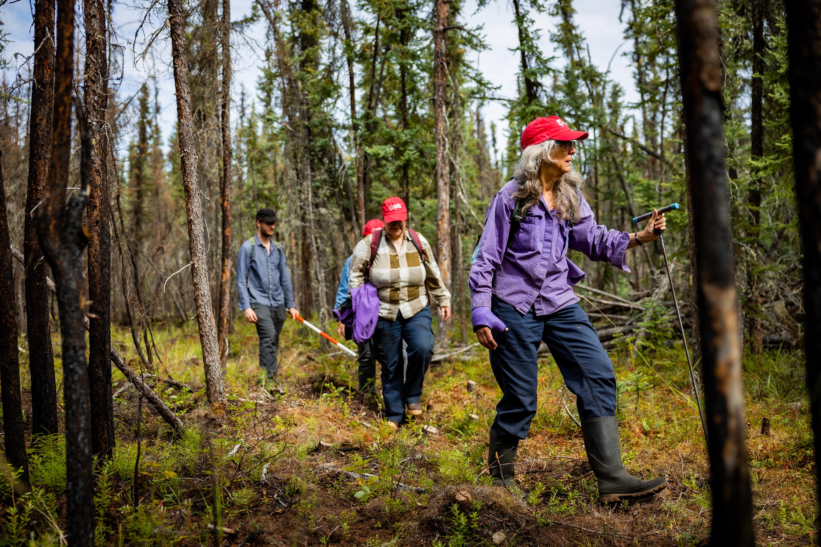
Researchers led by Alison York hike through the Yankovich Road Fire Site in August 2022.
The Yankovich Road Fire may have been a minor blaze – it consumed less than 4 acres – but the conflagration looms large in the eyes of Alaskan fire researchers. They’ve taken advantage of the fire’s convenient location on the University of Alaska Fairbanks North Campus to install monitoring transects for research and training purposes, and now plan to erect a set of interpretive signs to raise public awareness of wildfires.
“It’s mostly just that it’s so easily accessible,” said Alison York, coordinator for the UAF Alaska Fire Science Consortium (AFSC). “People know where it is, you can park there, you don’t need a permit… It just hit all of us at the same time, this could be a really nice self-guided tour opportunity.”
The Yankovich Road Fire began on the afternoon of July 16, 2021 on the northern edge of UAF, only a short distance away from the Skarland Ski Trail and from dozens of homes. Investigators concluded that a lightning strike had ignited the blaze a few days earlier, and it then smoldered until it was detected. Fortunately, the fire spread slowly due to calm conditions, and there were relatively few other fires in the state at the time, so firefighters were able to respond quickly with helicopter and airplane water drops, ground crews and even eight smokejumpers. The fire was swiftly contained to 3.6 acres, and stopped about 330 feet from the closest home.
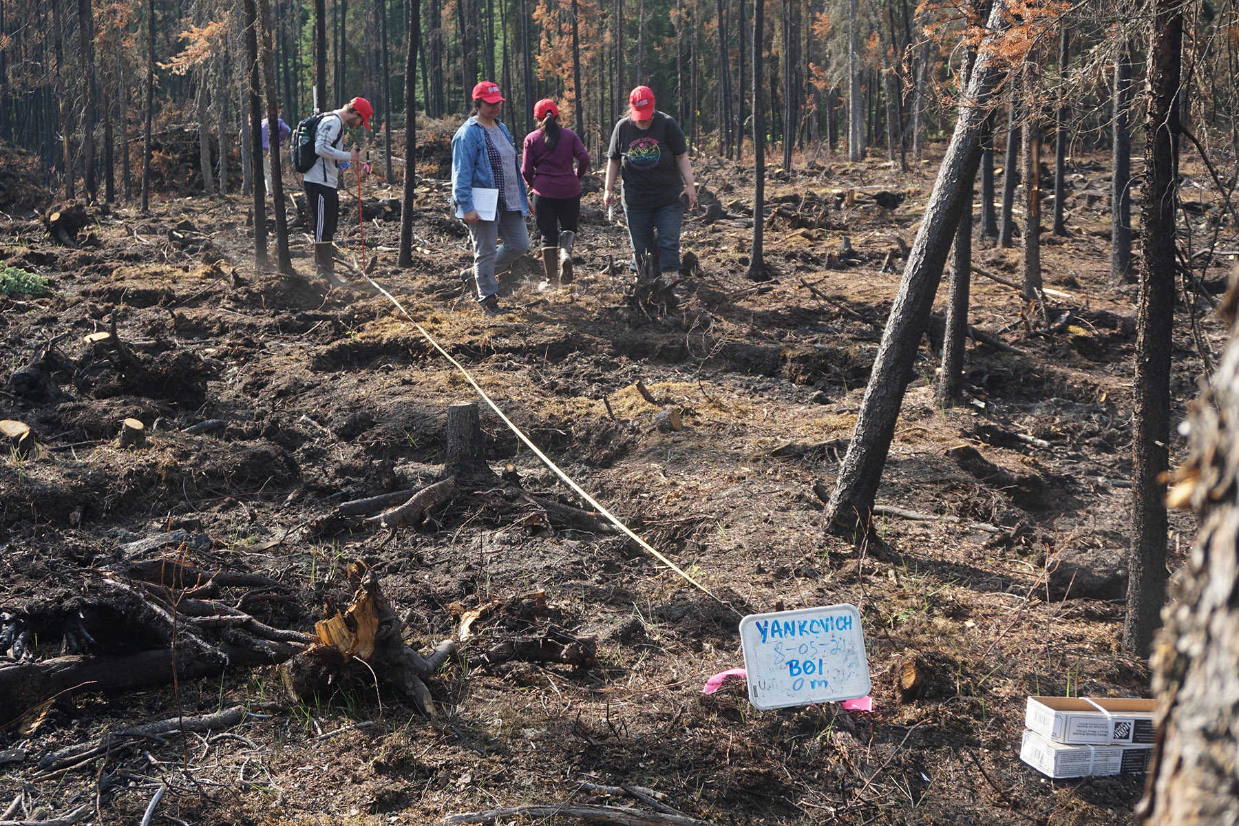
Researchers at the Yankovich Road Fire site in August 2021.
What was left behind was a representative example of a burn in the wildland-urban interface – the area where houses intermix with burnable forests – that’s a 10-minute walk from a public parking lot at the UAF Large Animal Research Station (LARS). Eric Miller, a Fire Ecologist with the Bureau of Land Management Alaska Fire Service, quickly saw the educational possibilities of the site. “What I was after was installing some transects to blend science and education, because I knew that often we have people coming into town, visiting scholars, or students, or collaborators, and they want to come out and look at a burn,” Miller explained.
Under Miller’s direction, researchers with BLM, the AFSC and the Alaska NSF EPSCoR Boreal Fires team descended on the area later in 2021 to install permanently marked transects to track post-fire changes in vegetation, permafrost, and fuel accumulation. They set up 30-meter transects both inside the burn and nearby to serve as controls, and sampled the transects in both 2021 and 2022 to track changes including living and dead trees, ground-level vegetation, permafrost depth, the thickness of the organic soil (“duff”) on the forest floor, burn severity, age of the burned trees, and the state of the substrate. York said one area of particular interest is the depth and state of the duff – she noted that the dryness of duff can be a major indicator of likely fire severity, and also that duff can lead to “zombie fires” under some conditions that can smolder for days, weeks or an entire winter before reigniting.
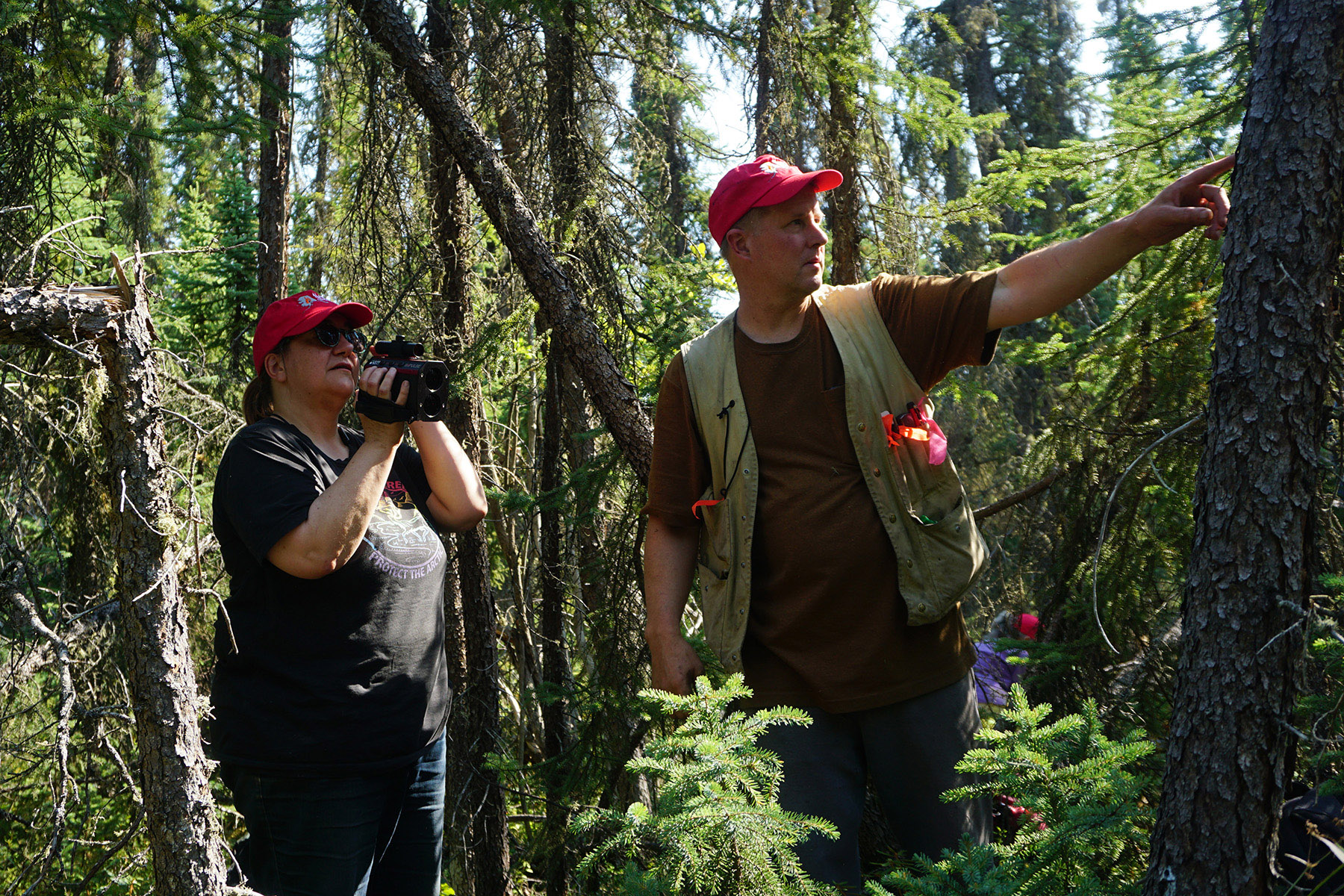
Researchers Chris Waigl and Eric Miller measure tree heights with a laser tree altimeter at the Yankovich Road Fire site in August 2021.
Fire researchers plan to sample the transects annually to track changes; chief among their interests are the speed and amount of colonization by invasive species such as vetch, white sweet clover, and dandelion, as well as what form the forest will take as it regenerates. “I think what people are interested in is whether the site is going to come back to black spruce, which it was before the fire, or whether it’s going to transform to a deciduous birch-aspen kind of forest,” Miller noted. “It’s still kind of early to say.”
Miller stresses that though the transects will provide valuable data, their main purpose is to provide a “field classroom” for education. Several EPSCoR faculty and students have taken part in their installation and monitoring, learning how to follow the protocols used to monitor fire effects in Alaska. This field data collection is key to ground-truthing EPSCoR Boreal Fires projects that use remotely sensed data from aircraft or satellites to map vegetation and fire severity across broad areas in Interior Alaska.
Miller has also been using the site to teach out-of-state fire crews about the boreal fire regime. At the same time, the site has quickly become a destination for guided field trips, including visits by school groups, participants in the “In A Time of Change” art and science collaboration project, and tours organized by the Alaska Chapter of the Society of American Foresters and the National Indian Timber Symposium.

Alaska NSF EPSCoR Boreal Fires co-lead Uma Bhatt (l) and postdoc Chris Waigl (r) inspect duff at the Yankovich Road Fire site in August 2021.
These visits in turn have grown into a larger project to make the fire site easily accessible to the public at large. The project team plans to install interpretive signage on a route leading from the LARS parking lot to the fire site on topics including the importance of wildland fire to the ecosystem; wildland fire management; ecological succession; the impacts of climate change to the boreal forest; and the importance of taking steps to protect homes from wildfire.
“The agencies that we work with said, we would really like to have some help in public education, especially around climate change and the wildland-urban interface,” York said. “To show that Alaskan residents need to be prepared that on any random July afternoon, a fire could be erupting in the woods behind your backyard.”
The general plan has been approved by UAF campus authorities, and the team will be working on graphics and specific messages for the signage over the winter with the goal of installation in summer 2023. Up to a dozen signs are planned and a short wood-chip trail would be installed through part of the burn site to improve access. Researchers also plan to interview nearby homeowners about their experience of the fire for an episode of the Alaska Voices podcast. The signs will include QR codes to enable visitors to find more details online, including updated information on changes to the site over time.
“There is interesting stuff at the site,” Miller noted. “Every time we go out there we notice something new.”
Financial support for the signage comes from the Alaska Fire Science Consortium, Alaska NSF EPSCoR, the USDA National Institute of Food and Agriculture Hatch project 1018914, and the State of Alaska. For more information visit the Alaska Fire Science Consortium web page about the project.